


WEATHER WATCH: Unorganized tropical depression creeps toward Louisiana
Published 9:52 am Monday, July 20, 2026
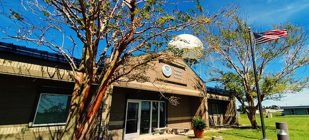
The National Weather Service’s Lake Charles office is located at 500 Airport Blvd. near Lake Charles Regional Airport. (Special to the American Press)
A tropical depression in the Gulf is moving slowly northwest but is expected to approach the Louisiana coastline by Wednesday, according to the National Weather Service Lake Charles
Storm Warning Coordinator Doug Cramer says the system is not yet well-organized, with most of its rotation sitting high in the atmosphere. As of Monday morning, the depression had maximum sustained winds of 35 mph and was located 110 miles south of Panama City, Fla
“I’ve got the satellite up and there’s some pretty good circulation across the eastern part of the Gulf of America,” Cramer said. “Most of that circulation is in the upper levels so it’s starting out as kind of like an upper-level trough and that low pressure is starting to make its way down to the surface so it’s not super organized by any means.”
What’s important to note, Cramer said, is the storm is dealing with a lot of dry air pulling in from Georgia and the Florida Panhandle
“That dry air is starting to make its way into the storm so that’s somewhat of a positive in terms of rapid potential orientation because that dry air is going to kind of slow down the evolution of the storm a little bit,” he said
Cramer said hurricanes feed off of moisture and humid air so the “chance for rapid intensification appears to be very low at this point, at least right now.”
The potential track for this tropical depression does include a route to Louisiana
“The storm is moving very slow — one mile per hour to the northwest, although it is expected to pick up speed over the next four to five days as it approaches the north Gulf and the coastal areas of Mississippi and Louisiana, potentially approaching the southeast Louisiana coastline sometime Wednesday morning and then move a little bit closer to Morgan City in south central Louisiana. Maybe Vermillion Bay sometime Thursday morning and then moving off into southeast Texas potentially by Friday morning.”
If the depression does become a storm, it will be named Bertha, the second named storm of the Atlantic hurricane season
“There is going to be the potential for good rainfall amounts, more likely on Wednesday into Thursday for Lake Charles, Alexandria and southeast Texas,” Cramer said. “If the storm takes a little more of a southern track in this cone of uncertainty and it stays offshore there could be the potential for some strong winds and the potential for storm surge. But if it makes it way inland early on and it stays on shore, then that would lessen the risk for some surge.”
While potential exists for tornadoes, it’s too early to determine that risk
